Why Research & Development?
Developing new or improved monitoring methods requires research and development focused on practical application. In contrast to fundamental or exploratory research GEOGLAM R&D is driven by the practical needs of the operational communities it serves. We call this ‘operational research and development’.
GEOGLAM's Research Agenda is shaped and advanced through four interconnected themes and working streams;
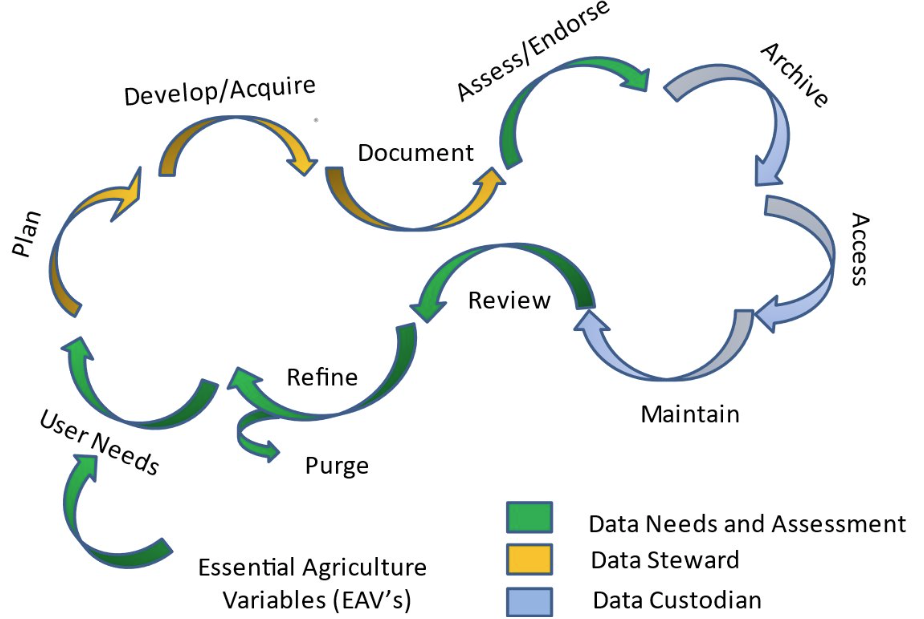
- Essential Agriculture Variables (EAVs)
- Joint Experiments for Crop Assessment and Monitoring (JECAM)
- In-situ Data Coordination
- Emerging Technology (NEW)
Essential Agriculture Variables
Essential Agricultural Variables for GEOGLAM are Earth observation-based “building blocks” that in combination with one another or with other non-EO information provide insight into the “GEOGLAM Agricultural Indicators” – which themselves provide actionable information on the state, change, and forecast of agricultural land use and productivity.
EAVs play a critical role in identifying key observational needs and highlighting gaps in both in situ and satellite observations. They help prioritize operational research and development efforts aimed at improving these variables and enhancing their relevance to policy. EAVs guide the research agenda for initiatives like JECAM and inform funding agencies supporting GEOGLAM. They also influence the planning of future missions and determine which variables need a "Compendium of Best Practices," an initiative under JECAM to document methodologies that yield high-quality data, which is then used by GEOGLAM's Capacity Development Team. Furthermore, EAVs directly contribute to GEOGLAM's activities, including the GEOGLAM Crop Monitor Bulletins and various global, regional, and national monitoring efforts that are part of the GEOGLAM network.
Joint Experiments for Crop Assessment and Monitoring
JECAM is GEOGLAM's research arm, which aims to enhance international collaboration around agricultural monitoring towards the development of a “systems of systems” to address issues associated with food security and a sustainable and profitable agricultural sector worldwide.
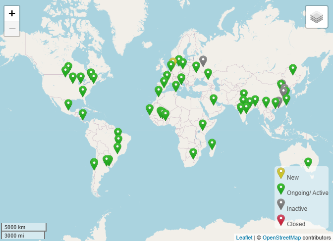
The overarching purpose of JECAM is to compare data and methods for crop area, condition monitoring and yield estimation, with the aim of establishing ‘best practices’ for different agricultural systems. The goal of the JECAM experiments is to facilitate the inter-comparison of monitoring and modelling methods, product accuracy assessments, data fusion, and product integration for agricultural monitoring. These international shared experiments are being undertaken at a series of sites which represent the world’s main cropping systems and agricultural practices. The approach is to collect and share i) time-series datasets from a variety of Earth observing satellites useful for agricultural monitoring and ii) in-situ crop and meteorological measurements for each site.
In-Situ Data Coordination
The GEOGLAM in-situ coordination initiative is guided by the requirements for the implementation of the Essential Agriculture Variables (EAVs). In turn, EAV priorities are driven by the requirements for the major policy drivers of GEOGLAM. Foremost, these drivers will include United Nations Framework Convention on Climate Change (UNFCCC) monitoring needs for adaptation and mitigation; United Nations Office for Disaster Risk Reduction (UNDRR), particularly early warning; and the communities’ contribution to the UN Sustainable Development goals (SDGs).


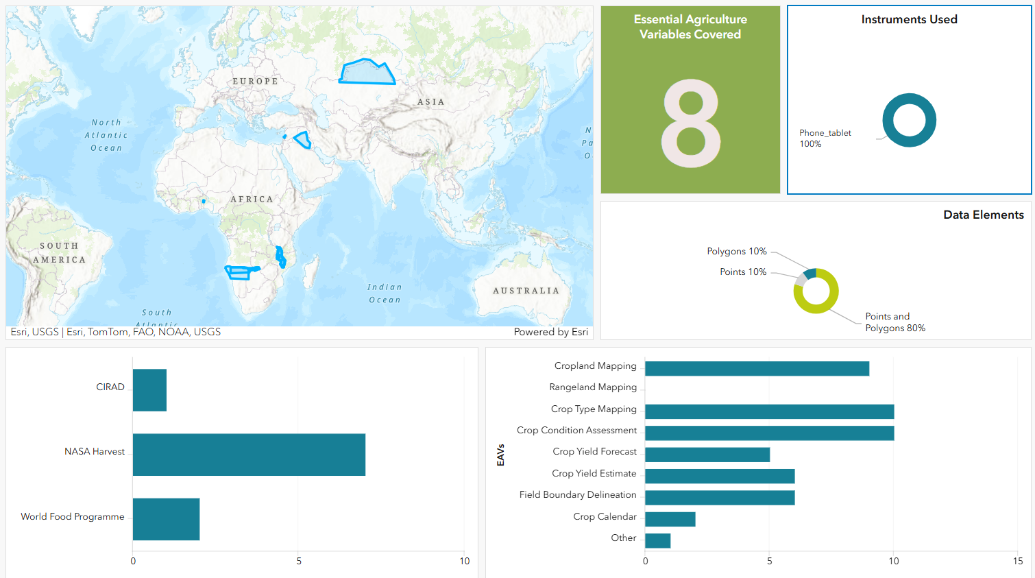
Provides a means to record and track in-situ activities so the community can share their field collection intentions, including:
-
-
- 1. Where and when field activities are taking place;
- 2. What EAVs are being collected;
- 3. How the data is collected.
-
Emerging Technology

What's new?
Explore emerging trends and new innovations in EO-based agricultural monitoring

