
GEOMAIZE began with a door opening thousands of kilometres away.
In 2023, the European Space Agency (ESA) launched an opportunity under its EO Africa Research and Development (R&D) call for proposals, a programme designed to strengthen Earth Observation (EO) science on the continent, support African-led innovation, and move EO research closer to real-world services. For those of us working at the intersection of climate, agriculture, and food security, it was a rare chance: funding that wasn’t just about publishing papers, but about building tools, training people, and creating operational capability in Africa.
At the Ghana Space Science and Technology Institute (GSSTI), we saw the EO Africa R&D call as perfectly aligned with a long-standing challenge in Ghana and across West Africa: reliable, timely, and scalable crop yield estimation at the end of the season. The question wasn’t whether EO could help—we already knew it could.
The real question was:
Can we translate EO science into an operational yield estimation system capable of informing national food security decisions at a scale that works under our conditions (smallholder fields, cloud cover, diverse management practices) and still produces decision-ready outputs?

That is the origin story of GEOMAIZE.
The partnership spark: GEOGLAM connects the dots
The project also proves an important truth in science and innovation: opportunity alone is not enough, the right partnerships turn opportunity into impact. Through the GEOGLAM community (the Group on Earth Observations Global Agricultural Monitoring initiative), partners across the world work together to strengthen agricultural monitoring using EO. It was within this collaborative ecosystem that our path crossed with colleagues who understood both the science and the urgency of operational crop intelligence.
A key moment came when GEOGLAM helped connect GSSTI (Ghana Space Science and Technology Institute) with VITO (the Flemish Institute for Technological Research, Belgium). That introduction quickly evolved into focused discussions: Where are the gaps? What could Ghana contribute? What does VITO bring technically? And how do we design a joint approach that is scientifically rigorous and locally relevant? Those conversations culminated in a joint proposal, a partnership built not on similarity, but on complementary strengths. GEOMAIZE was born.
Complementary strengths: different backgrounds, shared purpose
One of the most exciting aspects of GEOMAIZE is how naturally the teams complement each other. GSSTI’s strength is local context, crop monitoring, AI and field reality: knowledge of Ghana’s agricultural systems, relationships with stakeholders, access to sites, and experience in applied geospatial research with national relevance.
VITO’s strength includes deep expertise in EO-based crop monitoring, modelling workflows, and advanced AI-ready methods including experience with models and systems that can scale across regions and seasons. Together, the partnership created a pipeline where field truth meets EO intelligence. This wasn’t a “handover” collaboration. It was a true exchange – learning moved in both directions, and progress was made as a team.

Learning by doing: Foundation models, progress sharing, and knowledge exchange
From early on, GEOMAIZE became a hands-on learning platform.
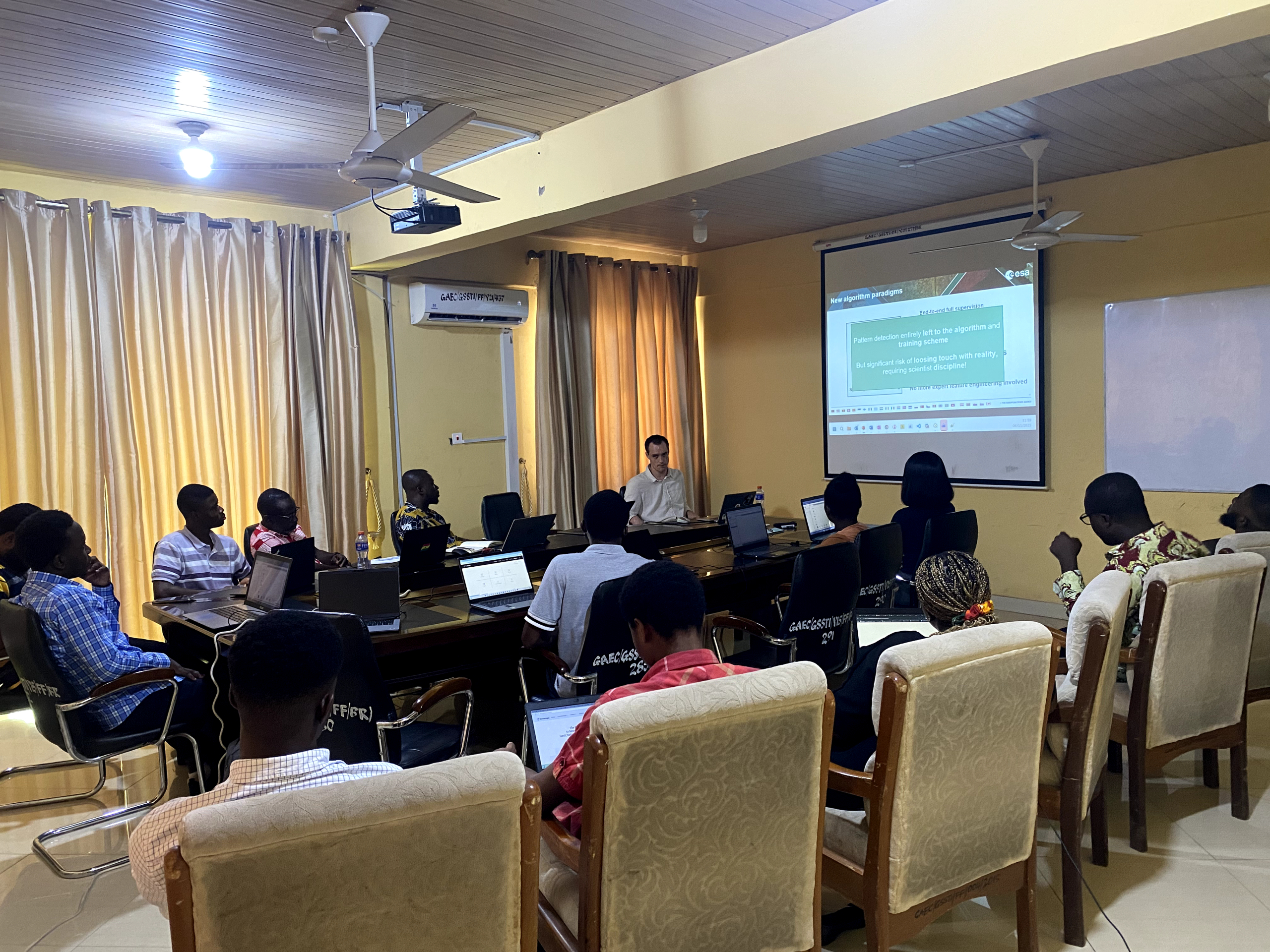
A major technical highlight has been the Ghanaian team’s exposure to, and growing competence with, tools and modelling approaches used by VITO—particularly in working with EO time-series methods and model frameworks such as the NASA Harvest’s Presto model. For the GSSTI team, it was an opportunity to deepen practical AI/EO capability: not only understanding what a model does, but learning the steps that make a model reliable—data preparation, feature engineering, validation strategies, and performance interpretation.
This collaboration quickly moved from ideas to execution. The teams shared progress continuously through regular weekly to bi-weekly virtual meetings, structured reporting, technical check-ins, and joint refinement of methods. The partnership also gained visibility at the international level, with joint progress reporting at ESA’s Living Planet Symposium in Austria, where GEOMAIZE was presented as an example of the kind of Africa–Europe scientific collaboration the EO Africa R&D programme aims to enable.
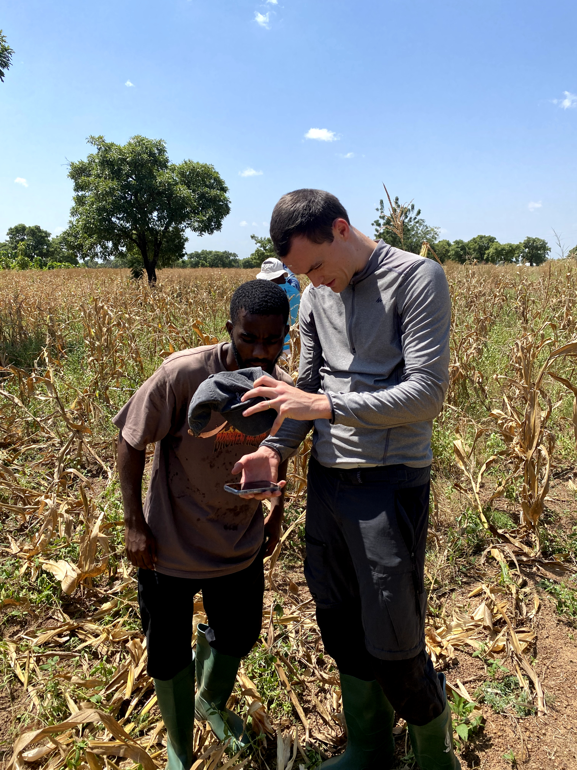
Another key milestone was Kristof’s (European PI) visit to Ghana, which was especially meaningful. Beyond meetings and presentations, the visit provided the invaluable chance for VITO counterparts to gain first-hand field experience seeing the farming context, observing yield data collection realities, and understanding the constraints that shape data quality. It strengthened trust, improved our shared assumptions, and sharpened the modelling strategy around what is feasible and what is most valuable to deliver.
In many ways, that visit captured the spirit of GEOMAIZE: no one is “remote” from the field realities. We build solutions with the field in mind.
Capacity building: WorldCereal and cloud computing as accelerators
Beyong modelling, capacity building was a central part of the project. If GEOMAIZE is about building yield intelligence, then training is the engine that sustains it.
Through the project, GSSTI researchers have had exposure to training and capacity building opportunities particularly around the WorldCereal platform and cloud computing workflows.
These trainings are not just technical add-ons; they are essential for scaling EO solutions across Ghana and beyond. WorldCereal provides an important foundation for crop mapping and crop monitoring, and cloud-based approaches reduce barriers caused by local compute limitations. For African institutions, these matter: a strong method is only useful if it can be run consistently, updated easily, and replicated across regions. GEOMAIZE therefore treats capacity building as a core deliverable, not a side benefit.
The field advantage: Collecting yield data and building yield algorithms
At the heart of GEOMAIZE is a simple belief: good models require good data.
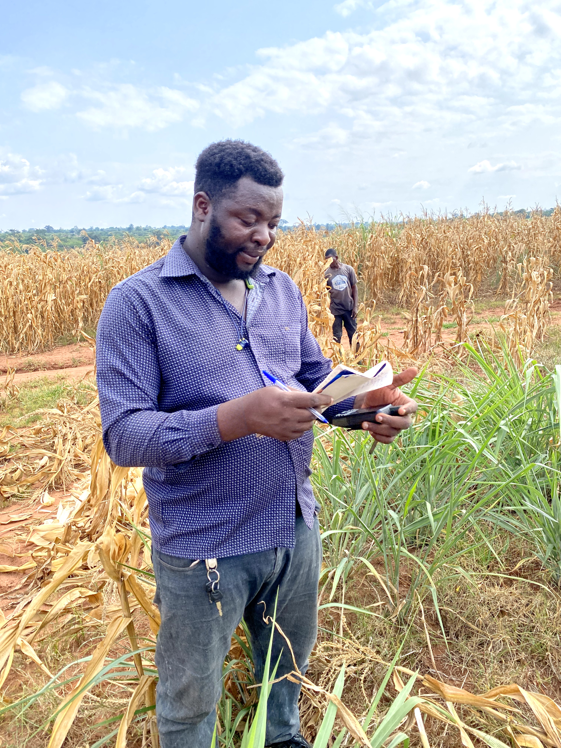
One of the most valuable opportunities the project has created is the ability to collect yield data and systematically experiment with it to build a yield estimation algorithm suited to local conditions. Yield data collection especially in smallholder landscapes demands careful planning, clear protocols, and consistent measurements. GEOMAIZE has supported this effort and positioned yield data not as a one-off campaign, but as a foundation for algorithm development.
With field data in hand, the project can now do what many EO initiatives struggle to do: move from generic modelling to locally validated yield estimation.
This includes testing yield formulas and correction factors, aligning field sampling with satellite revisit patterns, experimenting with predictors from EO time series (e.g., vegetation indices, phenology metrics), evaluating model performance across seasons and sites, and iteratively improving a yield algorithm that can eventually support early warning and planning. This is how GEOMAIZE turns data into value: from measurement to model to decision support.
From field reality to EO-ready data: lessons learned

A major learning component of GEOMAIZE emerged from confronting the limitations of previous yield data. Much of the historical data could not be directly reconciled with EO time-series inputs due to structural inconsistencies and missing metadata. Earlier yield measurements had quadrants level information but without recorded GPS coordinates, making precise alignment with satellite pixels impossible.
In addition, the previous quadrant size of 6 m × 6 m did not correspond to the 10 m resolution of Sentinel-2 imagery, introducing uncertainty in pixel-to-plot matching. In response, the team redesigned the field protocol: GPS coordinates are now recorded for each quadrant, quadrant size was increased to 10 m × 10 m to match satellite resolution, and metadata standards have been strengthened.
This process also reinforced an important scientific insight – while EO captures canopy dynamics and phenology effectively, yield is shaped by additional factors such as soil variability, management practices, pest, and seed variety. GEOMAIZE therefore improved not only the data collection, but also the discipline of collecting field data in ways that are truly compatible with operational EO-based crop intelligence.
Why GEOMAIZE Matters
In a time when climate shocks, market volatility, and food insecurity are increasing, crop intelligence is no longer optional. Countries need the ability to estimate yields reliably, track crop health, and detect emerging risks early.
GEOMAIZE matters because it demonstrates a practical pathway:
- ESA created the opportunity through EO Africa R&D,
- GEOGLAM enabled the partnership, connecting complementary teams,
- GSSTI and VITO built a shared workflow, grounded in training, field validation, and AI-ready methods, and Ghana now has a stronger foundation for developing an operational yield estimation pipeline.
- Most importantly, GEOMAIZE is not only building an algorithm—it is building people, systems, and long-term capability.
This is what ESA’s EO Africa R&D call envisioned: not only research, but capacity, collaboration, and practical impact. GEOMAIZE is proud to contribute to that vision—and to the future of operational crop intelligence in Africa.

0 Comments