Capacity (Co-)Development IN GEOGLAM

Our Guiding Principles


GEOGLAM is built upon common interests and good intent.

As such, these principles are aspirational and intended to help guide how different capacity development interventions are handled within GEOGLAM.

Start with existing capacities

CapDev interventions start with the capacities and capabilities that already exist within the engaged parties. Human capacities (skills and knowledge) and the capabilities of requester organisations, individuals, and institutions will be strengthened by bridging the gap between the existing and required competencies for the uptake of EO by staff, and by identifying the organisational needs to facilitate the strengthening of the required competencies.

demand-driven and impact-oriented

Starting with a need or demand for information is a critical component of co-creation that ensures projects begin with a clearly defined impact. Different frameworks can be used to understand the required interventions needed to reach a desired impact (e.g., Baseline Studies, Logical Frameworks, Result Chains, Strategic Pathways, etc.)

Co-creation

Many CapDev interventions focus on individual capacity strengthening via training, massive open online courses (MOOCs), webinars, etc., which share or transfer new knowledge, skills, and insights in only one direction. The GEOGLAM perspective is that these are effective tools for information sharing that must be situated within a more holistic co-creation approach to CapDev, one in which partners jointly share in the design and implementation of a CapDev intervention.

fit-for-purpose

A “fit-for-purpose” or “good-fit” approach requires a clear understanding of different audiences’ specific needs and builds upon existing capabilities. Consequently, the targeteted intervention should address the identified audience, each according to their needs, roles, capacity, interest, and influence.

Stakeholder engagement

Multiple stakeholders relevant to the intervention should be identified and engaged based on their specific role, interest, and influence. The spectrum of stakeholders ranges from hands-on users of EO-related technology up to the highest political level, with a broad range of actors in between. Hence, a range of engagement activities, including technical, political, and even personal, is essential.

Sustainability

Plan for continuity; the sustained provision of dependent data and services implicated in the CapDev intervention, as well as of sustained use of the EO data and tools within the requester organisation regardless of staff turnover.

Ensuring organisational, technical, financial, data, and academic continuity will be addressed during the project period and, if warranted, operationally sustained post project.

Social inclusion

Diversity, equity, equality, and inclusion are at the core of GEOGLAM as an international organisation. As such, we adopt the language and principles set forth by the United Nations General Assembly in its 2012 “Declaration of the High-level Meeting of the General Assembly on the Rule of Law at the National and International Levels.

We further amend this text to explicitly condemn discrimination on the basis of race, colour, ethnicity, national origin, religion, sex, gender identity or expression, sexuality, disability, age, marital status, family/parental status, or political beliefs. Simply, GEOGLAM as an organisation treats all partners as equals and selects partners without privilege or bias and expects all partners to do the same when working in this international context.
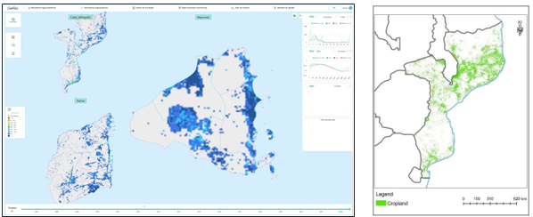
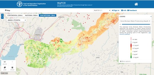
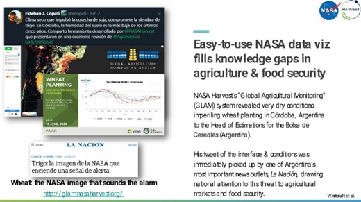
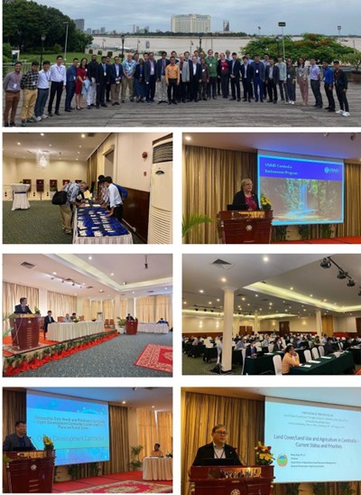
Case Studies

A national crop estimation system in South Africa

by

Terry Newby, Geoterraimage (Pty) ltd

Informed decision-making by all role players, a levelled playing field for marketing, and price stability.

The Disaster Risk Financing Program in Uganda

                                                                          by

                          Catherine Nakalembe, University of Maryland/NASA Harvest

The Earth observation-based early warning system has helped vulnerable households and enabled the government
to plan its budget and ensure that resources are utilised efficiently and effectively.

Between 2017 and 2020, US $14M of financing indirectly benefitted 90,405 households in north eastern Uganda. Over the four years, the early financing release saved the government roughly US $11M in reactive food aid costs.

Development of the agriculture watch platform For East Africa

by

Maria Dimou and Felix Rembold, Joint Research Centre of the European Commission, Directorate D – Sustainable Resources, Food Security Unit – D5

The East Africa Agriculture Warning Explorer is based on near-real-time Earth observation and weather information and provides automatic ten-day drought condition warnings for crops and rangelands at the provincial level.

This information and the indicators used are made available as maps and time series statistics in an interactive GIS environment to agricultural and food security analysts. The information is synchronised with the JRC’s ASAP Warning Explorer

Capacity development to produce the agro-meteorological bulletin for Angola

by

Maria Dimou and Felix Rembold, Joint Research Centre of the European Commission, Directorate D – Sustainable Resources, Food Security Unit – D5

The information regarding the progress of the agricultural season and the extent of the impact of extreme weather events can be provided with an agro-meteorological bulletin.

The bulletin includes, for selected provinces, a detailed analysis of rainfall estimate patterns based on Rainfall Estimates from Rain Gauge and Satellite Observations (CHIRPS) data in connection with available weather station data, and the development of vegetation conditions in cropland and rangelands based on the temporal profile and detected anomalies in normalised difference vegetation index (NDVI) time series data.

CropWatch For Enhancing Food Security Govern ance In Mozambique

by

Hongwei Zeng, Bingfang Wu, and Miao Zhang, CropWatch, Chinese Academy of Sciences

This training and customised platform have enabled MMARD to monitor national crop condition independently since 2018, directly addressing the prior lack of national agronomic information.

In 2019, CropWatch Cloud for Mozambique was selected as one of the best “rural solutions” by the International Fund for Agricultural Development (IFAD) due to its contributions in improving the capacities of Mozambique to access domestic and global agricultural information. .

Development Of An Online Agricultural Water Accounting Platform

by

Sven Gilliams, VITO, Belgium and Livia Peiser FAO, Italy

The portal provides an assessment, in space and time, of agricultural water and land productivity, productivity gaps, and capacity development to close these gaps. Next to this there is the dedicated capacity development of stakeholders to increase water productivity in a sustainable manner.

The Redevelopment Of GLAM For Operational Use By Major Production Countries In South America

by

 Alyssa. K. Whitcraft, John Keniston, Estefania Puricelli, and Michael Humber, University of Maryland

The system’s value is routinely demonstrated by its users, with Conab and the Bolsa regularly sharing resultant analytics from the GLAM 2.0 system in their official reporting, in their GEOGLAM CM4AMIS workflows, and in their unofficial (e.g., social media, presentations) communications and outreach.

Joint Workshops And Training Series Involving NASA LCLUC, SARI, GEOGLAM, NASA HARVEST, START, And National/International Partners

by

Krishna Vadrevu, NASA Marshall Space Flight Center, Huntsville, Alabama and Chris Justice, NASA
HARVEST, University of Maryland College Park, USA

The workshops held in Cambodia helped increase collaborations with Cambodian researchers in Agriculture and other thematic areas (forestry, airpollution, urban, wetlands, etc.) will be useful for building new projects; Increased interest by Cambodia’s Ministry of Agriculture in the potential use of remote sensing technologies for crop mapping, monitoring, and yield estimation; helped Early career researchers gain significant novel experience in the use of remote sensing and geospatial technologies useful for their research projects, among other outcomes.

Monitoring Rice Agriculture Under The Effect Of Climate Change And Anthropogenic Pressures [1]

by

Thuy Le Toan, Centre d’Eudes Spatiales de la Biosphère, Toulouse

VietSCO provide the following rice products: monthly rice maps (area, growth stage) and annual rice cropping density (Figure 19), together with dynamic flood extent during the flood season.

For visualisation of the impacted rice area under different scenarios of climate change and human pressure, maps of salinity intrusion and terrain elevation are provided (present and projections up to 2050, based on Eslami et al.,(2021), and Mindehoud et al., (2020).

Monitoring rice agriculture under the effect of climate change and anthropogenic pressures [2]

by

Shinichi Sobue, Thuy Le Toan and Kei Oyoshi, Japan Aerospace Exploration Agency; Centre
d’Études Spatiales de la Biosphère, Toulouse

VietSCO provide the following rice products: monthly rice maps (area, growth stage) and annual rice cropping density (Figure 19), together with dynamic flood extent during the flood season.

For visualisation of the impacted rice area under different scenarios of climate change and human pressure, maps of salinity intrusion and terrain elevation are provided (present and projections up to 2050, based on Eslami et al.,(2021), and Mindehoud et al., (2020).

Crop type classification empowers agricultural remote sensing monitoring in Mongolia

by

Hongwei Zeng, Battsetseg Tuvdendorj, Bingfang Wu, and Miao Zhang. CropWatch, Chinese Academy
of Sciences

Technicians of the National Remote Sensing Center, Information and Research Institute of Meteorology, Hydrology, and Environment (IRIMHE) were trained to master the entire processing chain of crop type classification, including in-situ data collection, satellite image processing, training of machine learning classifier, crop type classification, and validation.

EOSTAT – Ecuador: integrated use of EO data and process-based crop growth model (SALUS) for official crop statistics

by

Lorenzo De Simone, FAO; Bruno Basso, Michigan State University

The project has co-created disaggregated crop yield data that allows for informed decision-making by MAG, enhancing its capacity to predict crop yields ahead of harvest. A full assessment of outcomes will require a few more years of project implementation and continued efforts.